Sliding Mount Everest Nepal earthquake 3 Cm to the Southwest.
Beijing Earthquake-7.9 on the Richter scale that shook Nepal on Saturday, April 25, 2015 does not only destroy the Kathmandu Valley and settled more than 8,000 lives. Terrible lindu National Park is also shifting Mount Everest or Qomolangma--China-language-as far as 3 cm to the Southwest.
But not until Nepal earthquake impact on the world's highest peak, which soars as high as 8848 meters. According to the Agency's surveys, mapping, and Geological information of China.
Chinese media reports, the Government in Beijing has long been installing satellite monitoring system on the Summit of Everest, since 2005, to monitor the movement of the mountain.
A decade later known Everest moves 40 cm to the Northeast with a speed of 4 cm per year, and the higher the 0.3 cm per year.
"The Mount Everest of constant moves to the Northeast. And the earthquake made it bounce a little bit to the opposite direction, "said Xu Xiwei, Deputy Head of the Institute of Geology in Beijing's China Earthquake Administration, as quoted from the website of the China Daily. "The scale of the movement is still normal and do not affect life there."
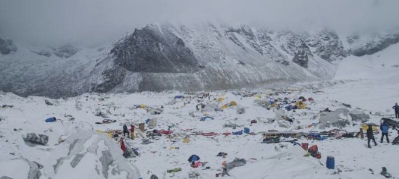
However, the earthquake that happened last April reversing the movement of the mountain--to the point where it is 9 months earlier. The time of the incident, it triggered a landslide in the mountain and its surrounding area, in the border of nepal and China, claimed the lives of many climbers.
A large number of deaths forced a number of tour providers to climb the highest mountains in the Himalayas cancelled the trip for the rest of the season.
The latest data from China pointed out, the second major earthquake which occurred on 12 April, with the power of 7,5 SR altogether not harass Everest.
The Chinese expert team's findings refute the analysis a number of earthquake experts estimate, Everest may shift up to a few meters in Nepal due to the earthquake. But predictions of the seismolog that typically do not change the unconfirmed truth.
Located on the border of China and Nepal, the mountain also known as Sagarmatha by the inhabitants of the Kathmandu Valley is located at the confluence of tectonic plates of Eurasia and India.
"By measuring the movements, scientists can study the principles of how the Earth's energies took off and carve out the scale of the energy released," said Xu.
"The Measurement helps us to find the source of the tectonic movements and observing abnormal movement when it happened."


